
Something to look forward to: The 3D view in Google Maps has become increasingly detailed and informative over the past year, offering users vivid previews of landmarks. Recent updates merge this progress with travel directions to provide a clearer picture of both a destination's appearance and environmental conditions. Google has also enhanced route details for in-car navigation.
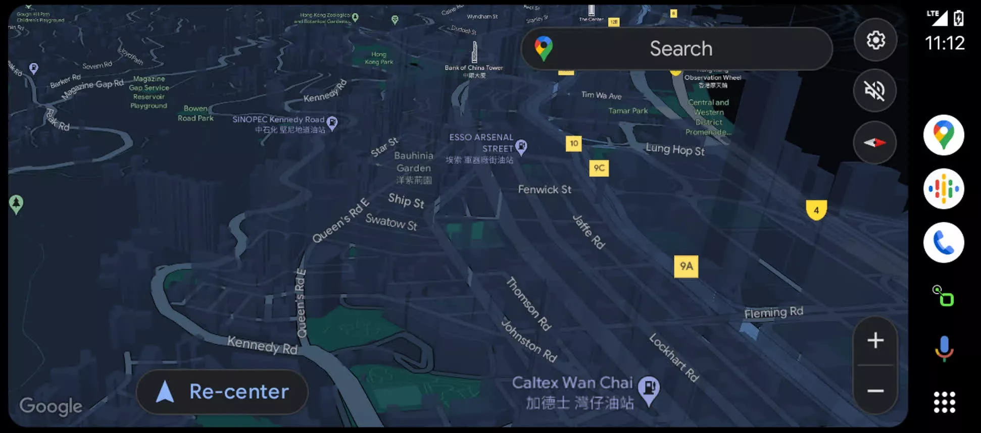
Users of Android Auto have noticed the ability to view 3D buildings in Google Maps during in-car navigation. While the smartphone app has offered a close-up 3D view for some time, testing suggests that Google plans to extend this feature to Android Auto and Apple CarPlay soon.
The timeline for the global or US-wide rollout of in-car 3D navigation remains unclear. However, users in Hong Kong and Canada have been able to activate this feature. Notably, tall buildings appear transparent to prevent obscuring routes. To access the 3D view, tap the layer icon and then select '3D' under map details.
This minor update might signal more extensive changes Google is implementing through 'Immersive view'. This feature renders locations more realistically while providing essential travel information. Users in some major cities worldwide could begin seeing it now.
In February last year, Google began integrating immersive view into Google Maps. This feature combines Street View images, satellite imagery, and additional data with neural radiance fields and AI to create realistic 3D models of streets and building interiors. Users can explore these simulated locations in real-time to understand exactly what their destination looks like from both a bird's-eye and ground-level perspective.
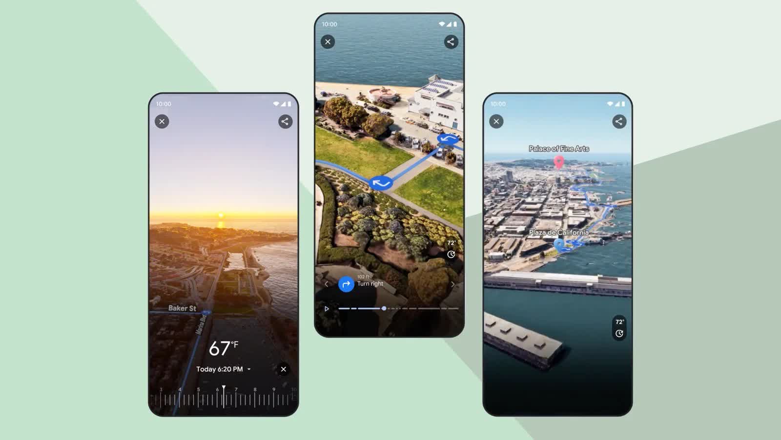
In May, Google introduced an update that adds similar detail across entire travel routes. Utilizing cloud-based rendering and machine learning, Google Maps can now visualize directions with detailed representations of buildings, vegetation, street signs, traffic, and more.
The app also integrates weather data to depict a location's appearance under various lighting and weather conditions. Furthermore, an analysis of historical traffic trends assists in predicting traffic flow based on the time of day. Late last year, the company began introducing the immersive view feature for routes in cities including Amsterdam, Barcelona, Dublin, Florence, Las Vegas, London, Los Angeles, Miami, New York, Paris, San Francisco, San Jose, Seattle, Tokyo, and Venice.
In related news, Google has started allowing third-party developers to utilize rendering data from Google Maps and Google Earth for creating specialized simulations. This could enable venues or tourism groups to use Google's resources to present 3D previews of specific locations.